Helping nomadic livestock farmers in Mali
by Peter Hoefsloot
August 12, 2015
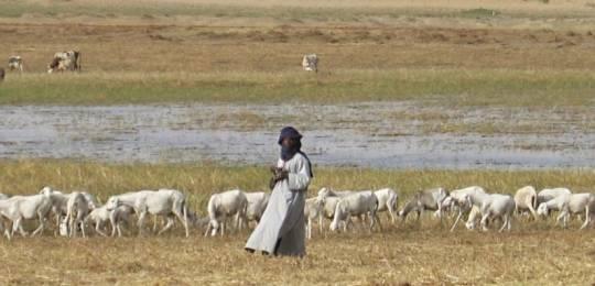
We have been awarded a multi-year project to help migrating livestock farmers with real-time information on grazing opportunities and water availability in Northern Mali. We will work with local and international partners such as SNV, ACF and Orange (French telecom provider). The project is partly financed by the Dutch Space Agency (NSO) through the G4AW facility.
Climate change affects plant communities in the Netherlands. Probe visualizes.
by Peter Hoefsloot
March 25, 2015
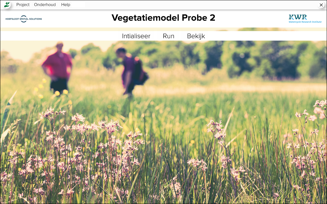
PROBE is a leading methodology for the estimation of the effects of climate change on vegetation in the Netherlands.
HSS is now creating software for the KWR Watercycle Research Institute. This will enable researchers and government institutions to use the methodology developed by Prof. Dr. Witte.
Probe2 is expected to be released in the second half of 2015.
HSS & PCI Receive Google Award Using Satellite Data to Help Pastoralists Find Greener Pastures
by Peter Hoefsloot
Project Concern International and HSS receive funding from Google today to expand the Satellite Assisted Pastoral Resource Management (SAPARM) program. SAPARM puts satellite derived vegetation data in the hands of pastoralists to aid them in making critical decisions on where to find available pasture throughout the year.
The current operational pilot program will expand in Ethiopia and Tanzania.”
We initially received funding from the U.S. Agency for International Development (USAID) to pilot the approach. Traditional grazing maps were developed on paper with communities. They were then digitized and overlaid with satellite derived normalized differential vegetation index (NDVI), which is a measure of photosynthetic activity. Updated and distributed every ten days, these maps are used with traditional methods, and significantly aid pastoralists in finding available pasture within approved grazing areas that can cover thousands of square kilometers.
Initial results from the pilot found that 78% of households used these maps for migration decisions and a majority identified the maps as their most important information resource. After using the maps in the pilot community, herd mortality dropped by 47% compared to the previous three years, which amounted to millions of dollars in herd value.
With a $750,000 grant, we will expand pilot programs in Ethiopia and Tanzania to scale and further test the innovation.
App to Monitor Drought in Nature Areas in the Netherlands
by Peter Hoefsloot
March 18, 2015
The Dutch province of Noord-Brabant has a number of nature reserves that are susceptible to drought. These parks are part of a European network of nature areas.
In corporation with KWR Watercycle Research Institute and FutureWater, HSS used groundwater modeling and remote sensing to monitor the “drought state” of these areas in the province: Groote Peel, Kampina and Brabantse Wal.
HSS has developed an App and a website to present the monitoring results to the public. Through GPS the mobile phone displays information of the spot visited.


